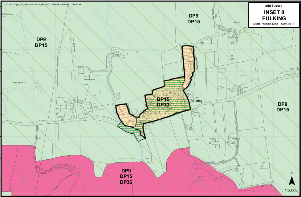
Fulking Draft Policies Map May 2013 (click image to see full-size version)
- DP9 — protection and enhancement of countryside (everything visible on the map except the core ‘built-up’ part of Fulking shown inside the thick black line).
- DP15 — South Downs National Park (everything shown on the map).
- DP33 — the Fulking conservation area (central pale yellow-green area plus green-blue area adjacent to the Shepherd & Dog).
- DP36 — biodiversity/site of special scientific interest (pink, the north escarpment).
You will need to look at the District Plan (PDF) itself for the fine detail of what DP9, DP15, DP33 and DP36 imply for development, for example.