
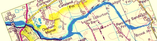
This post is not a flood alert! But you may have thought that river flooding is something that only happens elsewhere in the locality (e.g., along the banks of the Adur and its larger tributaries). The Environment Agency thinks otherwise and marks a strip of Fulking and Edburton that stretches north from Brook House, via Perching Sands, then west past Lower Edburton and Tottington Sands to Woods Mill. This strip is at significant risk of flooding where ‘significant’ means more than once every 75 years. The Agency’s map has been added to the end of the Local Geology page.
Risk area for flooding