
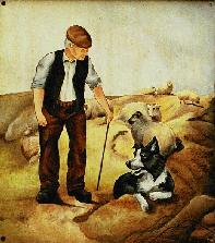
From the Shepherd and Dog
- A Walk Down The Street: less than a mile but packed with sixteen pages of history. You hardly need a map but one is provided in any case.
- A five mile circular walk from South Downs Discovery that takes the bostal to the top of the Downs, follows the South Downs Way west for a while, then climbs Edburton Hill to Castle Ring before descending into Edburton and returning to Fulking via Coles Automotive and the path through the fields behind Perching Hovel Wood. No map but reasonably clear directions.
National Trust Walks
Their web site currently offers seven professionally produced local walks as PDFs that can be conveniently printed, complete with relevant photos and OS map extracts:
- Walk on Fulking, two miles beginning and ending at The Shepherd and Dog and taking in the lime kiln, the remains of Fulking Grange, a Bronze Age bowl barrow and, in summer, butterflies, moths, orchids and wild thyme.
- Devil’s Dyke butterfly walk, one mile beginning and ending at The Devil’s Dyke pub taking one down to, and then up, the centre of the gorge via lots of moths, butterflies and chalk grassland flowers.
- Newtimber Hill butterfly walk, three mile circular walk starting at a lay-by on the Saddlescombe Road, overlooking Poynings. Dew ponds, newts, orchids, lots of butterflies and the possibility of a recuperative tea at The Hiker’s Rest.
- Wolstonbury Hill explore nature walk, nearly four miles in a figure of eight, starting at The Jack & Jill Inn in Clayton. Beech trees, bluebells, cowslips, wild garlic, a dew pond, the Bronze Age enclosure and superb views.
- Saddlescombe Farm and Newtimber walk, one and a half mile circular walk from Saddlescombe taking in the chalk pit, a possible bowl barrow, a Bronze Age dyke, a couple of dew ponds, the donkey wheel, and tea at The Hiker’s Rest.
- Devil’s Dyke histories and mysteries walk, three miles in a figure of eight starting at The Devil’s Dyke pub and the Iron Age hill fort, including a view of what is left of the aerial cableway, the donkey wheel, tea at The Hiker’s Rest, a steep climb that provides great views, and the remains of the steep grade railway.
- Ditchling Beacon to Devil’s Dyke, five miles end-to-end along the South Downs Way, via Clayton Holt, the Jack and Jill windmills, The Plough at Pyecombe, and Saddlescombe. If you have the time, add a side detour from the windmills to view the North Portal to Clayton Tunnel and the astonishing medieval murals in Clayton’s Anglo-Saxon Church.
From Devil’s Dyke
- An Urban75 report of a circular walk (five miles?) down through the gorge to Poynings, across the fields to Fulking, and then back up the escarpment to the Dyke. No map but lots of photos.
- A Discovering Britain account of a circular walk down through the gorge to Poynings Lake, and then back up the to the Dyke. Not written as a walk, no map but the web page has four photos. Printable two-page text-only version.
- A seven mile circular walk from Country Walking. A professionally produced PDF with a couple of photos and a good map.
- An eight mile circular walk following the South Downs Way to Truleigh Hill, then heading south to Southwick Hill, before returning to the Dyke via the Sussex Border Path. Several photos and a usable map.
- A thirteen mile circular walk from The Guardian that follows the South Downs Way from the Dyke to Upper Beeding and then loops back via Southwick Hill, Monarch’s Way and Saddlescombe. Clear directions and a schematic map that will need to be augmented by OS Explorer 122.
The Gorse Fox
This site once had a nice collection of South Downs Walks, all illustrated by numerous photos and small but useful maps. Here are three that are fairly local to Fulking and Edburton:
- A nine mile circular walk taking in Fulking Hill, Tenant Hill, Mile Oak Farm, the Southwick Tunnel, and returning via Thunderbarrow Hill, Bushy Bottom, and the South Downs Way.
- Another nine mile circular walk, this one via Poynings, Saddlescombe, Wolstonbury Hill, and Newtimber.
- An eight and a half mile circular walk that notionally starts in Bramber but can just as well be started in Edburton using the steps behind Springs Smoked Salmon. It will take you from Edburton Hill to Truleigh Hill, down to St. Botolph’s, and then back via Upper Beeding, Windmill Hill, and Truleigh Manor Farm.
The Argus

The Argus has a huge archive of Sussex walks, mostly circular ones provided by Eddie Start. Apart from the title photo, they are not illustrated. But the directions are very detailed and they all come with rather small schematic PDF maps (you will need to fiddle with the settings for your printer if you decide to print the maps out). Here are some examples:
- A three mile walk taking one from Fulking to Edburton across the fields behind Perching Hovel Wood and back along the foot of the Downs passing the the restored lime kiln.
- A four mile walk which takes in Fulking, Poynings, and three pubs. The map is poor.
- A six and a half mile walk from Woodmancote to Small Dole via Oreham Manor, returning via New Hall and Spring Hill.
- Another six and a half mile walk, this one from Henfield to Albourne via Blackstone, returning through Woodmancote and Henfield Common. Note the corrections in the comment.
- A seven mile walk that takes one from Edburton Hill to Mile Oak via Truleigh Hill and Thunders Barrow, then back via Summers Deane.
More here: Clayton, Devil’s Dyke to Ditchling Beacon, Ditchling, Ditchling Beacon, Foredown_Tower, another Henfield walk, the Jack and Jill windmills, Lancing Ring Nature Reserve, Pyecombe, and Saddlescombe.
Poynings
- A three mile circular walk leading to the Dyke and back.
- A similar, but not quite identical, three mile circular walk. From the AA, with a good map.
- A two mile figure of eight tour of the village and immediate environs.
[Avert your gaze from the solecism that identifies the Zion Chapel as a former synagogue.]
Henfield
- Historical walk around the village, no directions, no map, but lots of information.
- A short excursion along the muddiest section of the Downs Link, professionally produced PDF with good directions and a very clear map.
- Four circular walks, professionally produced PDFs with good directions and clear maps: Henfield in Spring; Henfield in Summer; Henfield South West; Henfield West.
- Three short circular walks with reasonably clear OS-based maps but the printable PDFs do not incorporate the absurd pop-up directions that some buffoon had included on the original web pages: Henfield Common to Woodmancote Place; Meeting the Adur; and Shermanbury Circular.
Steyning
Half a dozen professionally designed PDF walks with photos, clear instructions and detailed maps. The first three are the ones closest to Fulking and Edburton:
- Three Ancient Churches Walk: four miles, mostly following the River Adur to take you to St. Peter’s (Upper Beeding), St. Nicholas (Bramber) and St. Botolph’s, and passing St. Mary’s House, Bramber Castle and various hostelries en route.
- Bramber, Upper Beeding and the South Downs Way: three miles that include an ascent of Beeding Hill.
- River & Countryside Walk: six and a half miles on the plain to the west of the River Adur.
- Chanctonbury & Washington Walk: seven miles starting in Steyning, following the South Downs Way to Chanctonbury Ring, and returning along Mouse Lane to the south of Wiston Park.
- Rural Retreat Walk: a seven and a half mile figure of eight ramble through rural West Sussex, starting in Ashurst with a break for tea in Wiston.
- Steyning Horseshoe: a three mile excursion into the Downs. A more detailed map is also available together with further information about the Steyning Downland Scheme.
Walking Maps
These are mostly professionally designed PDF maps prepared by various branches of local government showing bridleways, byways, public footpaths, open access areas and relevant parking places for the Downs north of Brighton. They are a useful supplement to OS Explorer 122 because you can see at a glance where a walk will take you.
- Discover Hove Downland
- Dyke Railway Trail
- Devil’s Dyke Trail
- Woods Mill Nature Reserve (the map is awful)
- Chattri and the Windmills
- Ditchling Beacon Nature Reserve (another shoddy map from Sussex Wildlife Trust)
- Circular Walks around Ditchling Beacon
- Stanmer and Ditchling Beacon
- Steyning, Bramber and Upper Beeding
- Green Ridge, Windmill Walk and Coney Wood
- Downs Link Shoreham
- The Downs Link Route Map
- The Downs Link Six Stage Route Guide
- South Downs Way mileage chart
- South Downs Way drinking water and public taps.
WSCC has a useful ‘public rights of way’ map on-line. For planning a walk, it is both more detailed and more accurate than Google Maps. But they do not make it easy to print out the parts that you will need to carry with you.
If any local resident would like to contribute their own favourite walk to this page, please contact GJMG with details.
January 9th 2014: NT links updated.
March 25th 2016: many dead links repaired.
February 17th 2017: walk added.
March 16th 2017: link to WSCC iMap added.
July 15th 2019: various dead links repaired.
September 2nd 2020: walk added.