Dear Friends,
This time of year when the weather is hot, the undesirables are out knocking on doors to gain entry and possibly ROB you. Please see below further advice that may help your in making your decision to open your door. You may think my message is a bit strong, but I do not know of another way to tell people to be careful. I hear many times of burglaries where people still leave windows open, doors unlocked because I am just popping to the shops for a few minutes. It takes 2-3 minutes for a burglar to steal from you. Please, please be more aware about your security. Look after your neighbour and they will look out for you.
You can tell door-stop salesmen not to knock — and they have to listen (it’s an offence not to!).
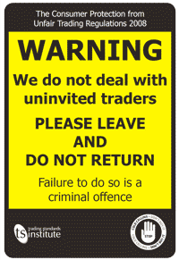
To stop them disturbing you print out Trading Standard’s ‘No Cold Caller’s’ sign (PDF) and put it by your front door. You have seven days to cancel most purchases over £35 made on the door-step. This cooling off period starts when you get written notice of your right to cancel (they have to give you one). If you cancel in this time you should get a refund (including your deposit). There are exceptions – check out the CAB website for details. Remember: the safest approach is to never buy on the door-step or let anyone in if you’re not sure who they are.
If someone knocks that you don’t know:
- Don’t answer if you don’t feel safe
- Always ask for ID and call the company to check
- Don’t sign anything on the spot – get details and do your own research
- Never hand over cash or agree for work to start straight away
- Call the police if you feel threatened
Best regards,
John Wright MBE
Chairman
Sussex Neighbourhood Watch Federation.
Mobile: 07917385213
Business:01444 247368
Email: enquiries@sussexnwfed.org.uk
Web: www.sussexnwfed.org.uk

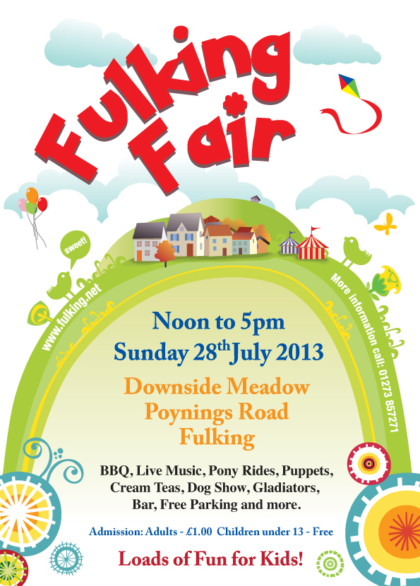 Fulking Fair 2013 exceeded all expectations.The weather was perfect, the attendance well up on the last fair and the dog show, food, drink, stalls, music, exhibitors, games, alpacas and owls were all brilliant.