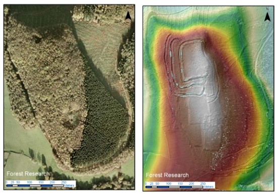
A regular aerial photo compared with a LiDAR image of the same area. The latter reveals archaeological features that are hidden in the former.
A special plane equipped with cutting edge technology is being used next week to search for the lost archaeology hidden under the South Downs National Park’s ancient woodland. While the South Downs are famous for Iron and Bronze Age monuments such as Cissbury Ring and Winchester Hill, a large part of the central areas of the national park lie under forests or woodland and almost nothing is known about their ancient history. The Piper Chieftain survey aircraft will be using airborne laser technology (commonly known as LiDAR) to map the ground underneath 30,000ha of woodland between the river Arun and the A3.
Rebecca Bennett said: “It’s a unique opportunity to unlock the secrets underneath these ancient woods. There are a few archive aerial photographs of this area capturing a tantalising glimpse of features revealed by felling during the second world war, but there is so much we don’t know about the history of the people who lived here.”
Our earlier post on this project is here.
