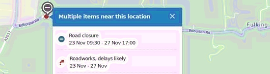
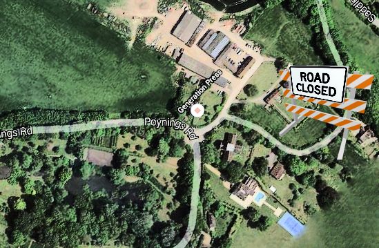
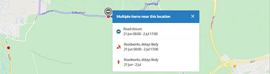
24hr Road Closure for South East Water to Cut out old Booster Station bypass and piece through and cut in meter. Closed from junction with Henfield Road to junction with Poynings Road with works taking place outside Tortington Manor [sic].
Category Archives: Topography
Fulking Conservation Area Reprise
This document will soon be plopping onto your doormat. If you live in the conservation area (current or proposed), please review it carefully. Mistakes have already been spotted. Send any that you notice to Trevor so that he can collate them for the Parish Council’s response.
The history of the issue is described here but you will need to respond to the new SDNPA document, not the old MSDC one.
Perching Wood restoration
Perching Wood* (also known as Hovel Wood and as Perching Hovel Wood) is afflicted by ash dieback. The infected trees need to be felled and a replanting scheme initiated (click the map above for details). Work is to start in September and October and the farm will manage the movement of timber lorries as sensitively as they can.
*If you have ever walked from Clappers Lane or the North Town Field to Edburton along the public footpaths then you will have passed the wood to your immediate left
Dog-leg closed-ish until Monday
Our most conscientious readers will recall that the same stretch of road was closed for much the same reason a couple of years ago: “dripping tap entails nine week road closure”.
Tiger Feet
It seems that UK Power have chewed up the footpath next to Lee Holden’s field (roughly by the 8-1F on the map above), while maintaining their installation. Walkers are warned to wear their boots or wellies for a while. Lee advises that while UK Power apologised, they also said that they wouldn’t be able to sort it out until the ground is a bit drier.
Miles Firth
The Beige Plague
In Horsham District, the infection persists. Their Strategic Housing and Economic Land Availability Assessment (SHELAA), January 2019, reads as follows (page 52):
This site has evolved from an area initially identified as a broad location of search following the publication of the 2010 New Market Town Study, commissioned jointly by Crawley Borough Council (CBC), Mid Sussex District Council (MSDC) and Horsham District Council (HDC). The developer has previously expressed a preferred approach for a development of up to 10,000 dwellings on land in both Horsham and Mid Sussex administrative areas. However, within HDC a development of up to 6,120 dwellings together with associated infrastructure is currently being proposed for consideration. The site falls in Woodmancote, Shermanbury and Henfield parish areas.
The site is in multiple land ownership, which may affect deliverability. Landowner interest in developing the whole site would therefore need to be carefully tested. There would also be a need for cross boundary working, with MSDC and with West Sussex County Council.
The site has a range of environmental and infrastructure constraints including an area of flood risk which would require mitigation. If developed, the site would need to create its own social, economic, transport and utilities infrastructure. Improved connectivity to the trunk road and rail network (which is some distance away) would also need to be carefully considered. Any major development would also need to take account of the retail viability of existing settlements such as Henfield. Unless allocated for development through the review of the Horsham District Planning Framework (HDPF) it is considered development would be contrary to Policies 1 to 4 and 26 of the HDPF and potentially other policies relating to the constraints of the site. It is therefore assessed as ‘Not Currently Developable’.