
The community website of the village of Fulking, West Sussex

West Sussex County Council
I am hopeful that if enough of us respond, the possibility of extending the high speed areas will be considered. I have suggested to WSCC that the NGA patches are extended to Clappers Lane, Holmbush Lane, and central Fulking. If you need something clarified, it might be worth telephoning Diane Williams at WSCC: 01243 777100.
Andrew Iversen (andrew.iversen@gmail.com)

A talk by Matthew Jones of the West Sussex Record Office to the Henfield History Group at 8:00pm on Tuesday 11th November, in the Free Church Hall, Henfield.

As readers who heard Peter Griffiths speak at the recent meeting of Fulking Parish Council already know, Mayfield Market Towns has been caught telling porkies. You can catch up on all the details at the LAMBS website. Nothing that Mayfield says in the future can be taken at face value.
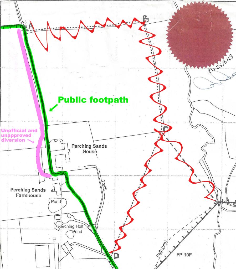
The DEFRA inspector charged with deciding whether Footpath 4f should be rerouted has ruled that it should not be. He concluded “that the adverse effect on the public’s enjoyment of the path if it were diverted in the manner proposed would be significant” and “the adverse effect on public enjoyment clearly outweighs the benefit .. to the landowners”. The proposed diversions (crossed out in red, above) will thus not come into force. Instead, the historic route (marked in green, above) retains its status as a lawful right of way. Here are some extracts from his report:
Footpath 4f runs .. almost immediately adjacent to the rear of Perching Sands House for around 40 metres. The public right of way runs past Perching Sands House in the way described, but that right of way has been unlawfully obstructed, and an unofficial path has been provided which passes some 10 metres to the west of the house.
The public right of way has been obstructed in the vicinity of Perching Sands House. For the purposes of assessing comparative convenience (and enjoyment) I take into account the lawful right of way, treating it as if it was open and available for use, and not the unofficial and unapproved diversion which has been created by the landowner.
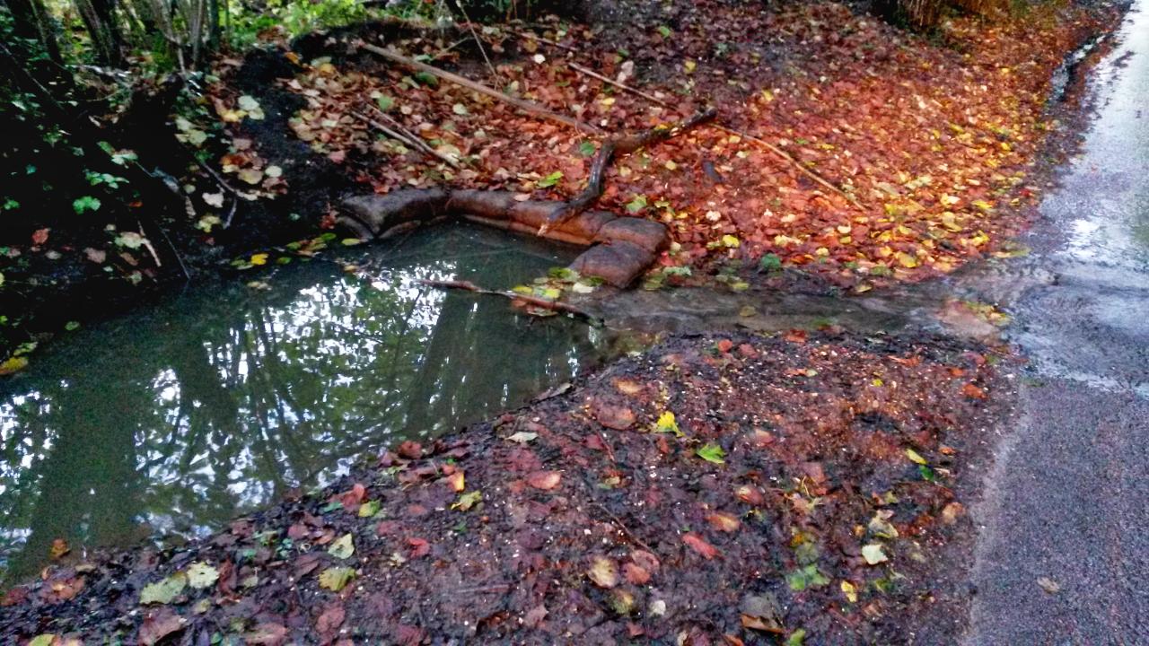
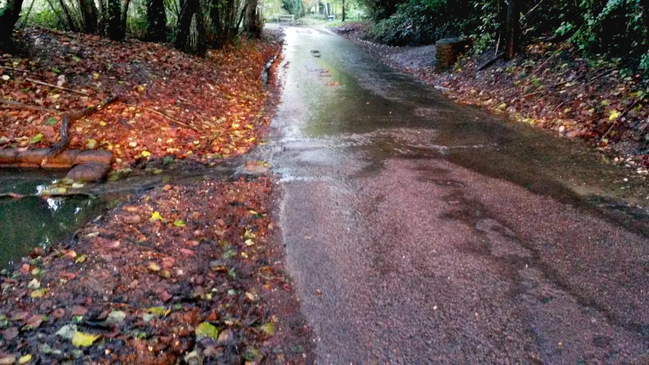
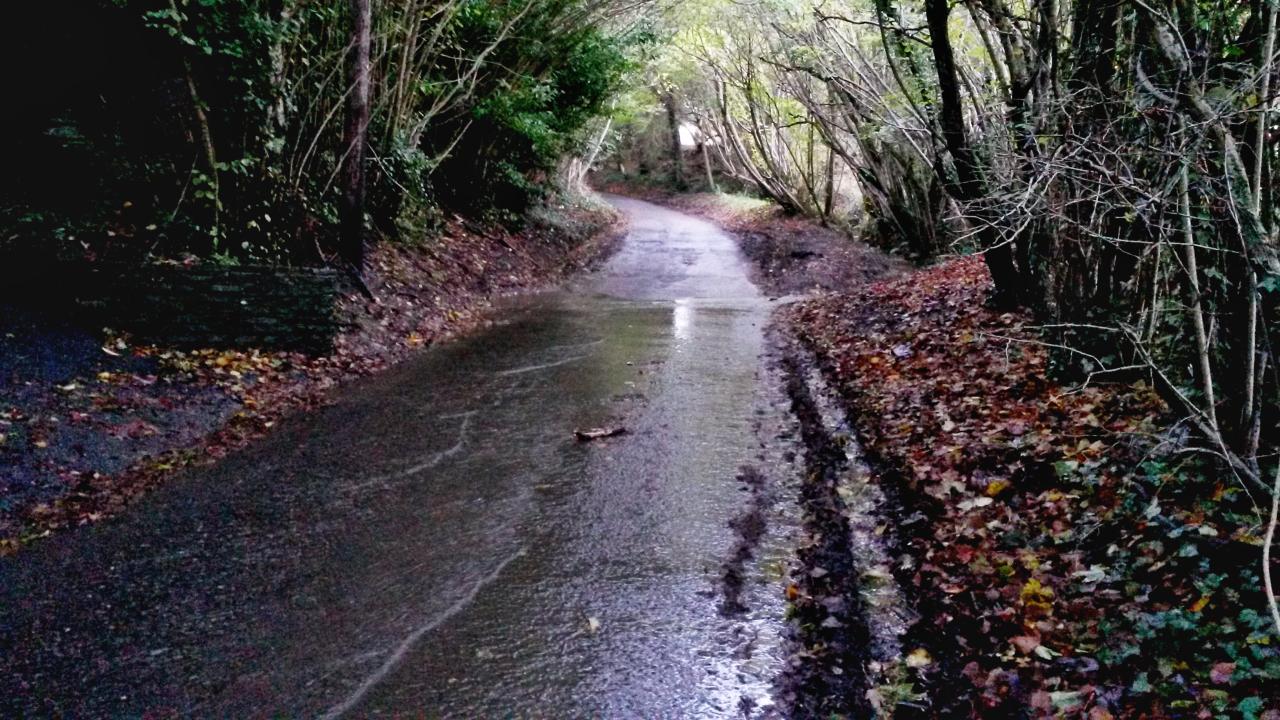
From the northern end of the curtilage of Perching Sands House to point A the right of way (although not the path provided by the landowner which lies immediately to its west) runs along a track with a good hard surface which seems unlikely to be muddy in wet weather (the site visit was carried out during a prolonged dry spell). The Definitive Statement for the path does not list any stiles or gates as lawful limitations on the public’s use.
It is reasonably clear where the path runs (or should run), and the correct route could be emphasised by signage so that there was no danger of people inadvertently wandering off the public right of way.
The full report is here [PDF].
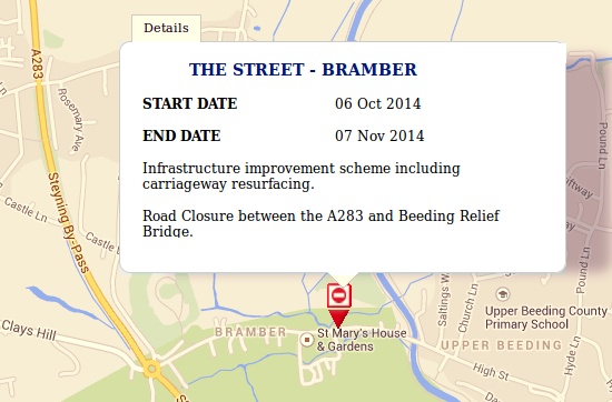
West Sussex County Council has finally begun to remove all of the speed bumps that have been causing damage to three of Bramber’s oldest houses: Yew Tree Cottage, The Gables and St. Mary’s House. The campaign by residents against the bumps has lasted for over twenty years. Buses are being diverted.
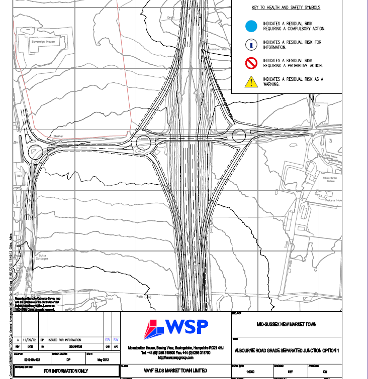
Mayfield Market Towns claim that
it is accepted by West Sussex County Council and the Highways Agency that .. proposals are shown and are agreed for how the development will relate to the A23 and to other major roads in the area. In essence, 4,000 dwellings can be serviced from a grade separated new junction at Albourne and closure of the Sayers Common junction, and Mayfield control the land to implement these two proposals.
[Mayfield Market Towns submission to HDC]