
Category: Topography
The terrain, vegetation, architecture and artefacts of the area described by reference to location.
The biosphere has landed
Yesterday saw the designation of the first new biosphere site in the UK for almost forty years and the first ever in South-East England. The Brighton & Lewes Downs Biosphere was awarded this designation by UNESCO at a meeting in Sweden on 11th June. It joins more than six hundred biospheres in over one hundred countries. All the available new information is here and our earlier posts on the topic are here.
Horton Clay Pit SSSI
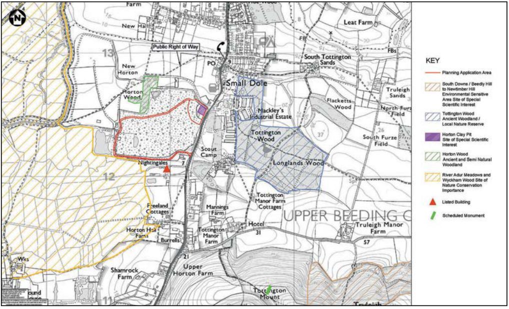
A Viridor residents newsletter [PDF] tells us that:
Viridor intends to submit a planning application in June 2014, accompanied by an Environmental Statement, relating to the infill and restoration of the Site of Special Scientific Interest (SSSI) area at the Horton Clay Pit.
In 1991, the former clay pit was granted planning consent for restoration using landfilling. A condition of this consent was that the SSSI would be retained and as a result the landfill was designed around it. The SSSI now forms one side of a shallow excavation with the landfill lying on the other side.
A recent technical stability report found that long-term remediation of the SSSI was not feasible. The only practical and sustainable solution is burial by
inert infill and restoration of the whole SSSI void to prevent any further erosion. Natural England has agreed in principle, subject to the Gault clay being protected by a marker layer.The scheme will establish additional grassland married into the existing adjacent restoration profile. It will also provide further woodland planting and establishment to enable habitat linkages across the restored landfill.
If you want to comment, the deadline is 3rd June. More information is available in the newsletter quoted above, the Viridor website, and at the Shoreham Herald.
BGS Weald Basin report
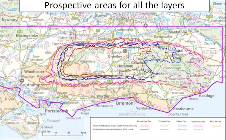
Today’s papers are full of shale! shock!! horror!!! in the wake of the new British Geological Survey report on oil and gas in the Weald Basin. Contrary to the impression given by the Telegraph, for example, the intersection between the South Downs National Park and the area thought likely to contain hydrocarbons is actually quite small. Fulking is well outside the core hydrocarbon area. If you want to learn more then read the report itself, not the reports of the report.
Ash to ashes [update]
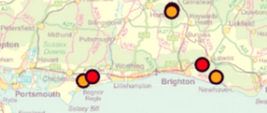
This soft-focus map shows Chalara fraxinea outbreaks in our region as of April this year. It does not look too alarming. But the disease is spreading rapidly and DEFRA now expects that 50% of ash trees in West Sussex will be infected by 2018. If you own ash trees you will probably want to take a look at the report [PDF] they issued on 30th April. Conveniently, it also covers the Oak Processionary Moth. In addition, they have issued a synopsis of the relevant research [PDF].
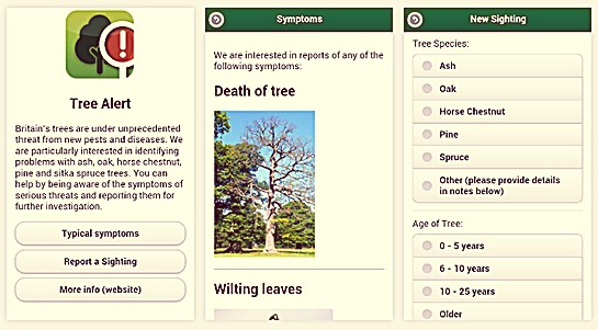
The Forestry Commission has released an app for Apple and Android devices that will assist you in recognizing and reporting tree diseases:
Steyning Downland Scheme
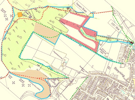
Steyning Downland Scheme have a handy two page PDF calendar of their events.
Click on the map to download it.
Psst, wanna buy Newtimber?
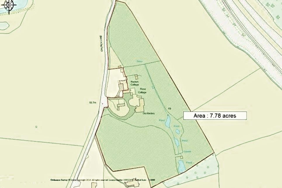
Well, most of it anyway. You’ll get fields, ponds, a stream, stables, and a small cottage. Oh, and there’s an old rectory thrown in. You’ll have to pay extra for the church.
Cycling from Shoreham
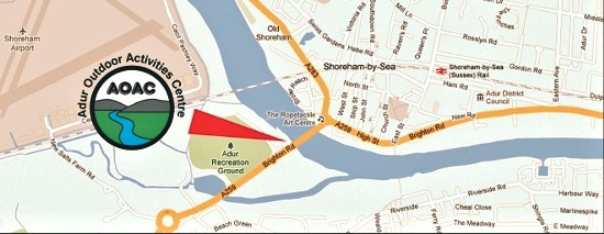
As from the beginning of this month, mountain bikes can be hired in Shoreham as well as at Hassocks. A visitor to Fulking can arrive at Shoreham by train, walk to AOAC, hire a heavily subsidised mountain bike, cycle north on the Downs Link, then turn east on the South Downs Way. Such a route avoids the road system almost entirely.
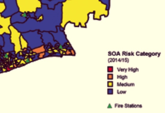
Tommy Brock safe in Fulking

West Sussex is a low risk area for bovine TB with a herd prevalence of around 0.1%, a level that has remained stable since 2006. So contractors with rifles are not likely to come after our large mustelid neighbours any time soon. If you really want to learn more then the just-published Strategy for achieving Officially Bovine Tuberculosis Free status for England [PDF, 85 pages] awaits your attention.
A24 — A27 — A23
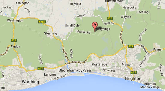
The charming rural hamlet of Fulking is conveniently located between three of the top ten main roads in the country — the A27 (ranked 5), the A24 (ranked 7) and the A23 (ranked 9). More here.