
Jen Green
The community website of the village of Fulking, West Sussex

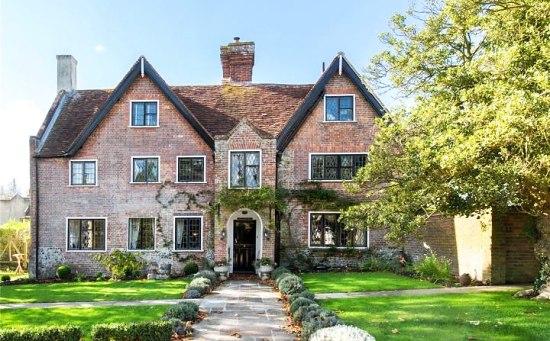
The finest house in Poynings is for sale — their nearest equivalent to our Perching Manor.
Added July 2019: it fetched £2,100,000.
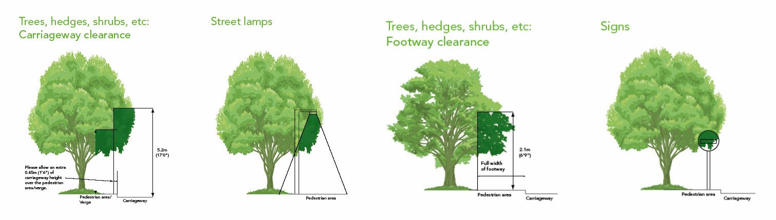
The West Sussex County Times recently had a somewhat helpful article on this topic. The WSCT article links, in turn, to a section of the WSCC website which is rather less useful since its focus is on what WSCC is meant to do rather than what is expected of private landowners. Luckily, Dorset County Council has produced a model flyer on the topic which is worth downloading (the illustration above comes from that flyer).
 Migration
At the risk of being corrected over omissions I think that over the last seven years, the number of properties sold, for sale or for letting in Fulking has been interesting. A little research shows that the properties involved in migration of any sort were:
Arcadia, Badger Brook, Badgerwood House, Barn Cottage, The Cabbage Patch, 15,21,29 & 41 Clappers Lane, Customary Cottage, Downside, Four Acres, Furzefield, Hillbrook, Hillside, Kent Cottage, Little Down, The Old Bakehouse, Oldwood, The Paddock, Perching Barn, Perching Manor, Pippins, 2 Septima Cottages, 1 & 2 Southview Cottages, 3 Teapot Row, Thatchly, Timbers, West Dean, West Orchard, Yew Tree Cottage.
That is 32 out of 137 or 23% of properties either sold, let or offered for sale! I find this interesting because in a parish like Fulking there is an old world feeling of permanence of residence which obviously is incorrect. As for Furzefield I think the impossibility of finding a suitable property in Henfield to move to may scupper any hopes you may have of stopping future Bobservations!
Most recent emigrants are Clive and Kate both of whom we shall miss. Kate was a very good Chair of the Parish Council at a difficult time. Parking will be easier in the Street!
Fun Dog Show
It has been agreed to hold a fun dog show in the North Town Field as part of the fair on Sunday July 29th 2018. Is there someone who would like to take on the organisation of this lighthearted event with full support from the Social Committee? If you would like to discuss it give me call on 857271 or email bob.pamrowland@btinternet.com
House Map
If you have not already looked at the magnificent Fulking Village web-site I suggest you take the trouble to look at ‘About our village’ and scroll down to ‘House Map’. Every residence in the parish has been marked on the map and indeed so have properties adjacent to Fulking. What a lot of amazing information has been put at everyone’s disposal. Many thanks to Gerald, John and Miles for putting all this together.
 Saturday 4th November at Henfield Hall, Coopers Way, Henfield, from 10:00am–4:00pm. Free admission. Selection of homemade cakes on sale, with tea & coffee.
Includes work by Fulking’s own Pauline Findlay.