The manor of Perching

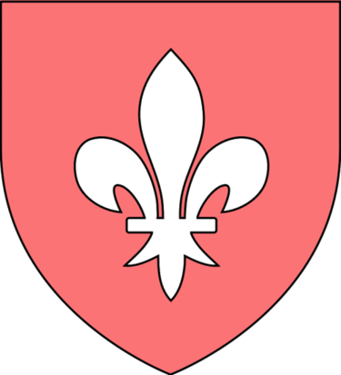
Gules fleur de lis argent

Gules fleur de lis argent: the arms of the wealthy and influential Aguillon family who held the manor of Perching for much of the 13th century.

Nowadays, we think of ‘a manor’ as being a house, probably a modestly grand one (but immodestly grand if built and named recently), or as police slang from the days of The Sweeney. However, for a significant part of England’s history, a manor was primarily a feudal estate and a local administrative and judicial unit. If the lord of the manor lived in a house on the estate then that house would have been known as the manor house. The estate typically contained farms and these were operated either by the lord of the manor himself or by tenants. Manors could be quite large: they might subsume an entire parish or even spread over more than one. In the case of Edburton, the historic parish contains four small manors: Aburton, Paythorne, Perching and Truleigh. Of these, Perching was by far the most important, especially during the Aguillon incumbency.

The four manors of Edburton, in common with others found along the South Downs, are oddly arranged to the modern eye. Together with Fulking*, they partition the parish into long thin irregularly shaped strips running from south to north. The explanation for this topography lies in the fact that the manors owed their existence to farming. Each manor was a self-contained mixed farming zone:

Each had its chunk of Down pasture, its rich malm and greensand arable under the Downs, its sticky wooded patch of gault clay beyond, and fertile lower greensand at the northern end. .. Each of the farmsteads had a daughter farm to the north on the lower greensand — Truleigh Sands, Edburton Sands, Nettledown, and Perching Sands. The woods of Tottington Longlands and Perching Hovel mark the poorly drained gault clay.
[Bangs 2008, page 216]

Sheep were grazed on the Downs, the northern escarpment provided chalk for lime and springs for a water supply, and the weald provided suitable land for crops, cattle, and rabbit warrens as well as woods providing timber and charcoal and a home for swine. In addition to the northern daughter farms listed by Bangs, at least some of the manors once had southern daughter farms located on the top of the Downs. Thus Paythorne had Summersdeane which had survived as a farm from Saxon times until Canadian tanks used it for target practice during WWII. In the case of Perching, the southern farm was probably located at the deserted medieval settlement to the east of the modern, but now dilapidated, Perching Hill Barn buildings.
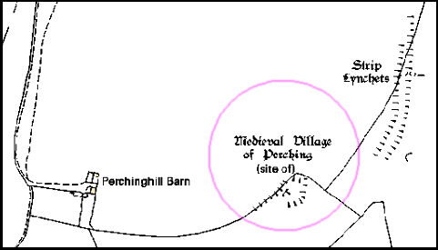
Site of the medieval_village of Perching

The site of the medieval settlement on Perching Hill. Note the strip lynchets — ploughed cultivation terraces. There was an underground water supply available, currently attested by the well adjacent to Perching Hill Barn.

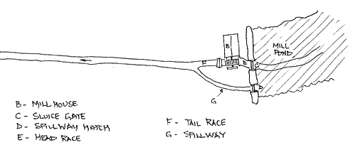
Perching had a watermill in 1086 when the Domesday Book was compiled. This was used to grind the grain grown by the lord of the manor and his tenants. The latter had no choice — they had to use their lord’s mill and pay for the privilege. The mill was located at the north end of the estate and had fallen out of use by the end of the eighteenth century. Howe [1958, page 22] notes the remains of a mill hatch which may mark the location.
Diagram of a Domesday-era water mill

Diagram of a Domesday-era water mill

After detailing the somewhat complex genealogy that explains how Perching came to the Aguillons, Howe goes on to tell us that:

Perching was now in the hands of a powerful family of considerable note. They were important in the county, for thirteen legal decisions are extant on their tenure of properties in Sussex other than Edburton between 1190 and 1298. They also held estates elsewhere, from one of the chief of which, Addington in Surrey, much can be learned which is of interest for Edburton. They were important to the crown as holding Addington by a service of cookery at coronations. The obligation was no doubt a proud privilege, just as to this day are the duties of bearing certain of the insignia at coronations. The duty is defined as “a sergeantry of making a hotch-potch in a yellow dish in the king’s kitchen on the day of his coronation or by deputy”. Perching was not held by this service, but the succession at Addington and Perching had been the same. The first Norman tenant of both had been Tezelin, the Conqueror’s cook. It is not only that the two manors were so closely connected, nor even the flavour of the kitchen, that is the most significant, but that the family was so closely tied to the crown at a time when so many of the feudal lords were in revolt. Robert, the son of William, and his heir and successor at Perching, was a devoted royalist, in whom the king had such confidence as to allow him to fortify his manor-house. In 1264 a licence [to crenellate] was granted. Meanwhile, Robert had died, in 1261, and in 1268 the licence was renewed to his son, also named Robert. [Howe 1958, pages 8-9]

In contrast to Victorian times, the desire to crenellate a manor was not an aesthetic matter, nor an academic one. The king would have wished to ensure that his supporters were in a position to defend themselves. This was a period when the king and the barons were in dispute. Robert Aguillon was loyal to the king but his overlord, the Earl of Warenne was a militant baron. Relations between them were not good as this document of a prosecution for trespass from 1274 demonstrates:

To the sheriff of Sussex. Whereas the king, at the prosecution of Robert Aguillon, lately ordered him to move the men of John de Warenne, earl of Surrey, archers and other armed men, who wander about Robert’s manor of Percynges and about his other lands, and lie in wait by day and night for his men, and aggrieve and disquiet them, from the said manor and lands, and the archers and other armed men, although warned by the sheriff on the king’s behalf to depart quietly from the manor and lands, still remain there doing worse damage to Robert and his men, whereat the king is moved: the king therefore orders the sheriff, if the archers and men still remain there and refuse to depart, to take them and keep them in prison until otherwise ordered. [Calendar of the Close Rolls, Henry III, 27th March 1274, quoted by Howe 1958, page 9]

When the younger Robert died, in 1286, Perching manor alone had been providing him with an income of around £100,000 per annum in today’s money (calculated on the basis of the relative price of eggs). And he was the lord of many manors.
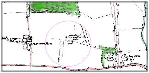
The site of the original Perching Manor House

The site of the original Perching Manor House

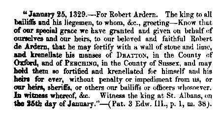
The building that the Aguillons sought and gained permission to fortify was not, of course, the house that we know as Perching Manor today. The thirteenth century Aguillon manor house stood midway between Paythorne and Perching farms in what is now a field, Frog Holt, immediately south of Perching Hovel Wood. Howe remarks that “it is not known when [it] ceased to be occupied or when it was demolished” [1958, page 33]. There’s not a lot left to see though a portion of the moat persists.
Crenellation licence issued to Robert Ardern 1329

Fortification of the manor continued in the fourteenth century

In the fourteenth century, Perching passed into the hands of the de Arderns, then Sir Michael de Poynings and thence, by marriage, to the Earls of Northumberland. When the 6th Earl was executed for treason in the sixteenth century, all his property was confiscated by the crown. The king then granted Perching to the father of the first Lord Montague (of Cowdray). When the last Lord Montague died, at the end of the eighteenth century, the estate returned to the crown. Throughout the seventeenth century, Perching was held by the Colstock family as tenants of the Montagues. During the time of the Rump Parliament, Thomas Colstock, a royalist, found himself having to appear before the sinister but delightfully named Committee for Compounding with Delinquents in order to retain control of Perching.


*The manorial status of Fulking is complex. It was once a component of the manor of Shipley, then became detached and was eventually absorbed by Perching [see Howe 1958, page 6 for the details]. The Old Farmhouse may have been the manor house.

References:

  • Dave Bangs (2008) A Freedom to Roam Guide to the Brighton Downs. Portsmouth: Bishop Printers.
  • F.A. Howe (1958) A Chronicle of Edburton and Fulking in the County of Sussex. Crawley: Hubners Ltd. [The definitive source on the early history of Perching. Most of the information presented above comes from Howe’s book.]
  • L.F. Salzman, ed. (1940) A History of the County of Sussex, Volume 7: The rape of Lewes. London: Victoria County History, pages 202-204. [This contains a lot of detail on the early history of Perching, albeit in a much less readable manner than Howe. But, unlike Howe, it is just a click away.]

GJMG

Updated 2nd March, 2013.

Currently popular local history posts:

The Dyke Railway 1887-1938

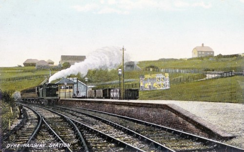
Dyke Railway Station around 1905

Dyke Station viewed from the south around 1905. Note the goods wagons to the right of the platform and the fenced lane leading up the hill. The farmhouse at top right was destroyed during WWII.

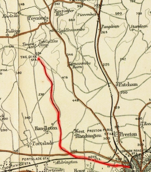
Plans for a railway to link Brighton to the Dyke were first mooted in the early 1870s but did not receive parliamentary approval until 1877. It took another decade before the railway was finally opened. In addition to the usual legal and property issues that attend the creation of a railway line, the overall gradient of 1 in 40 posed a significant technical challenge as did the hard chalk rock found at the end of the route. Indeed, the terminus of the line fell short of the Dyke by several hundred yards because the gradient at that point made further extension impractical.

Over the first year of operation, some 160,000 passengers were carried. The only intermediate stop at that time was at West Brighton (now Hove) Station. The total distance was 5.5 miles of which 3.5 were on the slope of the Downs. The trip took twenty minutes (just as the 77 bus from Brighton Station does today). The first additional intermediate stop to be added to the line was Golf Club Halt in 1891. This was a private platform built on what was then the property of Brighton & Hove Golf Club and provided for the use of its members. Two further intermediate stops opened in 1905, both on the main Brighton-Portsmouth line: Dyke Junction Halt (later renamed Aldrington Halt) and Holland Road Halt. The fourth, and final, addition was Rowan Halt built in 1933 to serve the new Aldrington Manor Estate that was then being developed to the north of the Old Shoreham Road.

The railway remained in operation for half a century with the exception of a closure of three and a half years at the end of WWI. When the line first opened in September 1887, there were eight trains a day (five on Sundays) between Brighton and the Dyke (and conversely). In June 1912, there were eleven trains a day (one fewer on Sundays). In November 1938, the penultimate month of operation, there were sixteen trains a day (half as many on Sundays). Conventional locomotives were used for most of the line’s life although a prototype steam railbus (essentially a large bus mounted on two bogies) was employed on the line in the mid-1930s and proved to be very popular with customers.

Dyke Railway map from the 1890s.

An 1890s map showing the route of the Dyke Railway

Although useful to members of the various golf clubs situated between Brighton and the Dyke, the primary passenger function of the railway was to take day trippers up to the Dyke in the morning and bring them back in the evening. Demand was thus seasonal and weather-dependent. Many of these visitors would use the Dyke as the basis for a day’s walking. Teashops sprang up in the villages at the foot of the Dyke to cater for their needs. Fulking and Saddlescombe each had one and Poynings had four at one stage. For those unwilling to stray off the Dyke itself, refreshments were also to be had at the Dyke Hotel and at Dennett’s Corner which was only a few yards from the station. A secondary passenger function was to take residents of Edburton, Fulking, Poynings, Saddlescombe and the various local farms into Brighton. The roads were poor and buses did not reach the Dyke until the 1930s. If you were not wealthy enough to have the use of a horse or, later, a car, then access to Brighton was difficult before the railway was built. Locals used the service to shop in Brighton and others commuted to work there.

Passengers were the main focus of the railway. But it also offered a goods service and this was economically important to the local villages. A goods siding was built at the Dyke Station in 1892. Coal, coke, cattle fodder and parcels were transported to the Dyke and collected from the station by horse and cart or by the local coal merchant. The latter then delivered both coal and parcels in the villages (and was paid a penny for each parcel by the railway company). On the return journey, goods wagons would take straw, hay, grain and local produce from the farms and market gardens into Brighton. Goods traffic was discontinued in January 1933.

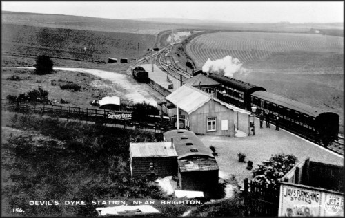
Dyke Station viewed from the north around 1911

Dyke Station viewed from the north around 1911. Note the signal box, the goods siding to the left of the platform, and the fenced lane, complete with ‘Suttons Seeds’ billboard, leading from the station to the roads to the Dyke Hotel and to Saddlescombe. The old carriage, with attached sheds, in the foreground was used as a refreshment room. In a very similar contemporary photo, a horse and wagon can be seen drawn up besides goods trucks in the siding (Harding 2000, page 10).

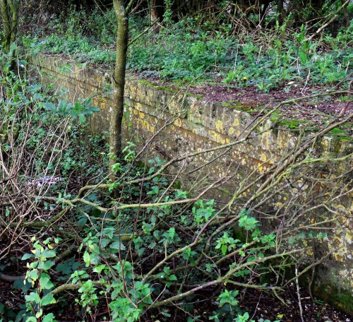
Golf Club Halt was a request stop rather than a real station. It never appeared in the rail timetables. However, the wishes of club members were reflected in the details of those timetables. There was a platform but that was all. You couldn’t buy a ticket for it — you had to purchase a ticket for the Dyke Station. If there were golfers on board, then the train would stop there to let them off. On the return journey, the train would stop to pick up golfers if they were visible on the platform (after dark, they struck matches). The platform was (and is) some fifty yards north of the clubhouse, perhaps because the gradient adjacent to the clubhouse made a more convenient location infeasible. However, from 1895 on, when a train was about to leave the Dyke Station, a bell would ring in the clubhouse alerting departing members to the need to make their way to the platform immediately. Although club members had mostly taken to using motor cars in the 1930s, the halt remained in use (especially when the weather was poor) until the railway itself was closed.

Golf Club Halt 2012

Golf Club Halt — the edge of the platform in 2012

What remains of the railway today? South of the bypass, Brighton’s urban sprawl has eradicated almost every trace of it. Aldrington Halt remains in use, albeit unmanned. North of the bypass, the route is still visible either from the sky or on the ground, but you need to know what to look for. The cuttings and embankments that were needed to make the uphill route possible are there and dense scrub marks the location of the track for several long stretches. A public cycleway (the Dyke Railway Trail) running parallel to, or along, the track extends from the bypass to Brighton & Hove Golf Club. From then on, the line of the track runs through private farmland but a strip of scrub reveals its presence. Much of Golf Club Halt, which was never more than a platform, is still there, hidden in the scrub. At the northern terminus, Devil’s Dyke Farm now stands where Dyke Station once was. All that was left of the station a dozen years ago was a small chunk of the platform.

Further reading:

  • Paul Clark (1976) The Railways of Devil’s Dyke, Sheffield: Turntable Publications. [This booklet contains a detailed history of all aspects of the line and includes maps, photos, transcripts of relevant documents, and engineering diagrams.]

  • Peter A. Harding (2000) The Dyke Branch Line, Byfleet: Binfield Print & Design. [Reprinted in 2011, this well illustrated booklet is currently the most readily available work on the history of the railway.]

  • Hove Borough Council (1989) Dyke Railway Trail [PDF], a four page leaflet. [The map contains a number of errors: e.g., both the exact railway route and Golf Club Halt are mislocated. Nevertheless, the leaflet is still useful if you plan a walk in the area.]

  • Barry Hughes (2000) Brighton & Hove Golf Club: A History to the Year 2000. Brighton: B&HGC. [Pages 27, 30, 33, 42, 48, 60-61, and 115 contain material relevant to the railway and Golf Club Halt.]

GJMG

Some other material relevant to the C19 and C20 history of the Dyke:

Dew Ponds

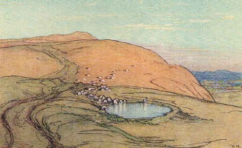
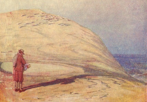
Donald Maxwell 1926 Sheep Drinking

An illustration by Donald Maxwell for Rudyard Kipling (1926) Sea and Sussex, London: Macmillan, page 15.

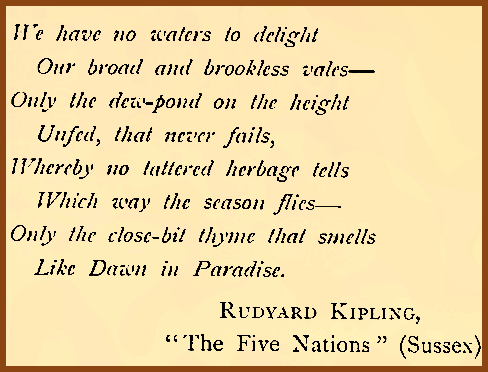
The National Park Authority reports that “there are approximately 300 dew ponds across the South Downs”. Of these, at least eighteen are within easy walking distance of Fulking. The closest is on Tenantry Down, immediately above the village. This post considers what these relics are, how they worked, and why they are there.

Rudyard Kipling 1902 Sussex

There’s no water on the top of the Downs. No streams, no springs, no lakes, and few naturally occurring ponds. The Downs are made of porous chalk rock. When it rains, the water drains straight through. Livestock need water to survive. In a world equipped with powered pumps, galvanized troughs, and tractors that can tow water tanks, the need is relatively easy to address. But efficient steam pumps only became available towards the end of the 18th century and tractors only at the end of the 19th century. In earlier centuries, the traditional way of creating a supply of potable water was by digging a well. But this solution is of very limited applicability on the Downs. The water table is a long, long way down. Excavating a deep well is difficult and dangerous — gas seeps into the shaft. And making use of it, once excavated, requires prodigious amounts of energy. Thus there are few wells to be found on the Downs. One that does exist is at Saddlescombe, which sits at a relatively low elevation of 410 feet (compare Devil’s Dyke at 680 feet). The well is 160 feet deep and, when it was in use, employed a donkey in a wheel to provide the energy needed to raise water.

Cross section of a typical dew pond

Cross section of a typical dew pond

For at least a millennium, dew ponds (also known as ‘mist ponds’, ‘fog ponds’, ‘cloud ponds’ and, somewhat unsurprisingly, ‘sheep ponds’) provided the solution to the water collection and storage problem on the Downs. We know that such ponds existed in Saxon times and it has been argued that their construction and use goes back much further. Dew ponds are shallow man-made circular ponds commonly lined with compacted (‘puddled’) clay or compacted chalk paste. Since the nineteenth century, concrete has also been used as a waterproof liner. Other components found at some ponds include straw, lime, chalk rubble, gravel and stones. In the nineteenth century and the early years of the twentieth century, specialist teams toured the Downs during the winter and spring months and built or restored dew ponds. It would take four men about a month to excavate and line a pond. Horses or oxen walking in a circle were used to compact the clay.

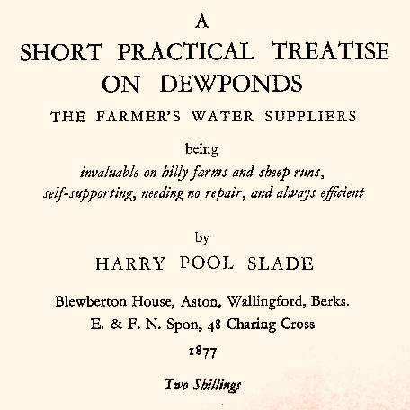
Harry Pool Slade 1877

The life of a dew pond has been estimated at 100-150 years. Sustained extremes of temperature, whether high or low, can lead to the compacted liner developing cracks. And the roots of reeds or rushes can burrow through it. In the absence of maintenance, the pond starts leaking, the water drains out, and it grasses over. If it is still required, then it must be dug out and relined. Depending on the construction, the hooves of livestock can damage the lining and thus one sometimes sees a pond that is entirely fenced off but which supplies a nearby drinking trough via a pipe (the pond on Tenantry Down appears to involve this arrangement). Typical dimensions include a diameter in the range 30-60 feet, a depth of 3-6 feet, and a capacity of 10,000 gallons. Precipitation, at over 36 inches per annum, is the source of the water in dew ponds on the Downs. Evaporation reduces that amount by about half. Scientific controversy over candidate sources of the water in dew ponds persisted into the 1930s. Nowadays the ostensible motive for the restoration of dew ponds (as at Foredown Road), or even their creation de novo (as at Waterhall Bottom), is an ecological one. It is intended that they provide a habitat for amphibious reptiles, dragonflies, and waterfowl.

Donald Maxwell 1932 Dew Pond

Frontispiece to Donald Maxwell (1932) A Detective in Sussex: Landscape Clues to the Riddles of the Past, London: Bodley Head.

Appendix: A gazetteer of dew ponds near Fulking.

For more information about dew ponds, see:

  • Alfred John Pugsley (1939) Dewponds in Fable and Fact, London: Country Life.
    [The best available book on the topic. It includes a critical survey of the earlier literature.]

  • Philip Heselton (1997) Mirrors of Magic: Evoking the Spirit of the Dewponds, Chieveley: Capall Bann, pages 34-72.
    [Whatever you make of the rest of the book, chapter 2 provides a reasonable substitute for Pugsley and may be slightly easier to get hold of. The geographical focus of the book is on the Yorkshire Wolds rather than the Downs.]

  • Martin Snow’s 2006 website dewponds.co.uk contains much material of interest.

  • Valerie Martin’s 2012 catalogue of the Findon dew ponds.

GJMG

Currently popular local history posts:
Fulking Farmhouse

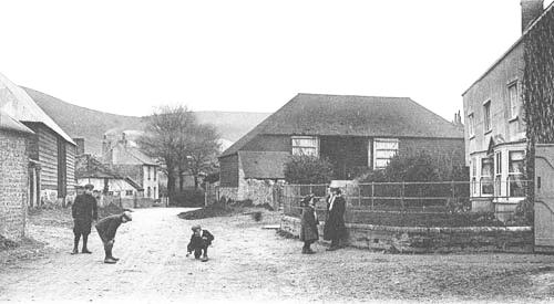
Fulking Farmhouse in the 1900s

Fulking Farmhouse in the 1900s (note false façade)


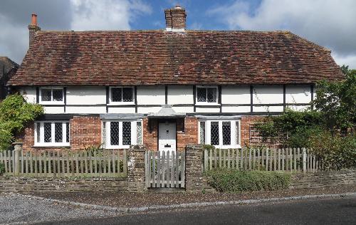
Fulking Farmhouse was built around 1650 and, as its name suggests, was originally a substantial farm property, one with several associated barns. It is of timber frame construction. The timber frame was concealed by a false façade in the 18th century, and this façade was only removed in the late 1930s.

Fulking records between 1910 and 1934 show that Thomas Hills was a tenant until an auction in 1934. At that auction the house was bought by Thomas (Tommy) Walton who had built up a chain of grocer’s shops in Hove and Brighton. He also purchased the adjoining fields which extended north, along the west side of Clappers Lane as far as Brook House and west to the stream that runs from the Shepherd and Dog. The farm became known as Walton’s Farm. Tommy’s sister Eileen lived there, whilst Tommy himself lived at Greenacres in Poynings.

Fulking Farmhouse and barn in the 1900s

Fulking Farmhouse (right of picture) and barn in the 1900s


During World War II, Henry Harris cultivated the farm under the terms of the wartime agricultural policy. In 1950, the Waltons sold the land, farmhouse and farm buildings to Harris. And he, in turn, later sold most of the farmland and all the buildings to Jack Cook who owned a well respected building company in Hove. While Jack lived in Fulking, he was instrumental in bringing about a number of changes along The Street. Several of the old barns had already been taken down by the early 1950s and the removal of one of Jack’s barns meant that the road could be widened to accommodate the increasing number of larger cars, vans and lorries that were now passing through Fulking. It was also at about this time that he built three new houses in The Street. And, in 1953/4, he donated the land and materials for construction of the village bus shelter.

Jack Cook later sold the house and he and his family moved to Shaves Wood Lane in Albourne. Since that sale Fulking Farmhouse has passed through several hands. In 1987 the house was purchased by a family who, over the ensuing twenty years, restored many of its original interior features and carefully preserved much of the house’s character.

Fulking Farmhouse in 2012

Fulking Farmhouse in 2012


Tony Brooks

[Copyright © 2012, Anthony R. Brooks. Adapted from Anthony R. Brooks (2008) The Changing Times of Fulking & Edburton. Chichester: RPM Print & Design, pages 153-154.]

The Hills at Pippins 1922-2011

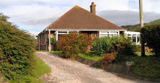
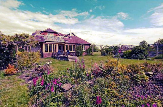
Pippins in 2007

Pippins in 2007

Pippins stands on land that previously comprised two adjoining plots: Kent Field, described as arable and orchard; and Lower Kents, described as pasture, orchards and buildings. Both lots were purchased by Thomas Hills in a 1922 auction for £200 and £160 respectively. At the same time, he also purchased three adjacent cottages: Arcadia (for £215) and Yew Tree and Clematis Cottages (for £260). The entire holding extended north from the Poynings Road to Clappers Lane and included all the land as far as the boundary of Market Garden to the east.

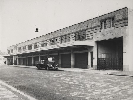
Thomas Hills cleared and cultivated the land. In 1934, he started to build the bungalow. It was originally called ‘The Bungalow’ rather than ‘Pippins’. When he died in 1935, his youngest son Francis continued to work the land as a market garden with help from his wife Florence (known as Flo). They sold their produce through the wholesale fruit and vegetable market in Brighton (see photo below) and later, as the wholesale market became less reliable, from the back door of the bungalow.

Brighton Municipal Market, Circus Street, built in 1937

Francis Hills was a committed churchgoer. In his younger days he had cycled to Henfield every Sunday to attend services. He was also a stickler for traditional growing methods and loved work for work’s sake. He preferred to dig and hoe his 3+ acres by hand rather than use a plough or any other equipment because it helped to pass the time and keep him fit. The story goes that one cold winter’s day, when a bitter east wind was blowing, a newcomer to the village saw him digging and said, “You shouldn’t be doing that at your age, you will make yourself ill. Why are you doing it?” Francis replied, “Because! I don’t know any other way to stay alive!” He died in 1981, just a fortnight short of his 91st birthday.

In later years, Francis’s son Richard helped his parents with the market garden. As an extension to the back door sales, Richard also established a round in Brighton on two days a week, selling fruit and vegetables. After his mother died in 1977, Richard married Susan (Sue) in 1978 and moved to a greengrocer’s shop in Worthing. On the death of his father, Richard and Sue moved back to Fulking. By this time the market garden was no longer an economically viable business due to its small size and the increasing competition from rapidly expanding supermarkets. Richard then set up in business as a contract gardener and also started work in a local vineyard. Richard and Sue sold up and left Fulking for Hove in 2011.

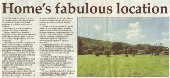
Pippins, Poynings Road, Fulking

An advertorial for Pippins in the local press when it was on the market in 2011

Tony Brooks

[Copyright © 2012, Anthony R. Brooks. Adapted from Anthony R. Brooks (2008) The Changing Times of Fulking & Edburton. Chichester: RPM Print & Design, pages 145-146.]

Pippins Poynings Road Fulking

Pippins in 2015

History of Local Names

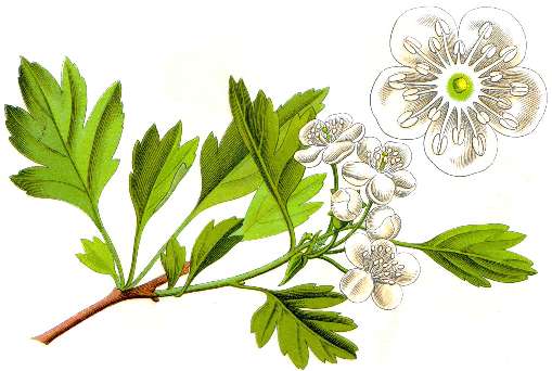
Common Hawthorn (Crataegus monogyna)

Common Hawthorn (Crataegus monogyna)


Paythorne

The oldest surviving spellings all suggest that Paythorne is named from a thorn-tree (hawthorn) associated with a Saxon man named Paga. This should have come to be pronounced “Pawthorn”, and documentary records right through to the 19th century prove that that is what happened. The alternative and current name is suggested by the Peathorne found in 1830, if the ea is as in steak, and it has not been explained. It may have been due to someone’s knowledge of the place called Paythorne on the Yorkshire-Lancashire boundary near Gisburn.

Pauethornam (Latin) in late 11th cent., Pagethorne in 1288, Pawthorne in 1633

Fulking

Fulking is an Anglo-Saxon name in –ingas, like Hastings, originally a name for a group of people but applied to a place (rather like Sussex ‘the South Saxons’). At Fulking, they were people associated with a man named Folc or Folca whose name meant ‘folk, people’, who is unknown to history. This name is not recorded by itself, but it occurs as the first element of names like Folcbeorht and Folcwine, and in Norman names like Fulk(e) which spring from the continental relative of the same element. In Hastings, the –s of –ingas has been retained, but in Fulking it has disappeared, and that is in fact what usually happens. Historians used to talk about the men whose names appear in place-names like this as tribal leaders or founding fathers of families, but we actually have no idea what relation the person bore to the group: father, godfather, hereditary or chosen leader on the basis of military or agricultural prowess, entrepreneur, slave-owner, or whatever: hence the vague “associated with”.

Fochinges in 1086, Folkinges in about 1091 and in 1260, Folkyngge in 1244, Fulkyng in 1327

Perching

Perching is a very difficult name whose origin is not known for certain. It seems to be an –ingas name like Fulking, but there is no known Anglo-Saxon personal name to suit the first part. If one were really clutching at straws, one might see a survival of the Roman name Poricus seen in that of the statesman Marcus Poricus Cato and members of his clan, which would reach the required form through known sound-changes in British Celtic and Old English. It may be an unrecorded Old English *perec (pronounced “PERRetch”) which could be an ancient English borrowing of Latin parochia ‘parish’, though there is no obvious reason for that. It might represent a variant *perric of the word pearroc, the source of park and paddock (and possibly itself derived from parochia), though what ‘people of the paddock’ might imply is equally obscure. It might not be an –ingas name at all, but a plural of a derivative of this word, *perricingas ‘the railed or fenced areas’. In this respect, it is interesting but probably misleading that in medieval times land was held of Perching manor for the service of fencing Earl Warenne’s deerpark in Ditchling.

Berchinges, Pʼcinges in 1086, Percinges generally in early Middle Ages, Perchinges in 1327

Close-up of part of a brass wall plaque in St. Andrew's, Edburton

Close-up of part of a brass wall plaque in St. Andrew’s, Edburton


Truleigh

Truleigh was until recently pronounced “true lie”, with the stress on the second syllable, a curiosity of Sussex, mainly Wealden, names containing Old English lēah ‘wood, clearing’ which dates back some 500 years. It has been claimed that the first element is trēo(w) ‘tree’, the whole meaning ‘clearing marked by a tree or trees left standing’. That is not linguistically impossible, but it seems much more likely to contain Old English trēow or trūwa, meaning ‘truce’, with reference to unknown historical events. Its position less than a mile from the boundary separating historic West and East Sussex (Bramber and Lewes rapes) may be relevant.

Truleg’ in the 13th cent., Treweli in 1261, Treule in 1281 (Trailgi in 1086 is misleading)

Edburton

Edburton is the farm or village of a woman named Ēadburg ‘wealth fortress’, whose identity is unknown. She is more likely to have been an overlord than an actual farming tenant or free peasant, but we cannot be sure. There were many prominent Anglo-Saxon women with this name. Since at least the 13th century the village was known as Abberton, and this pronunciation is retained in the name of Aburton Farm, the manor farmhouse.

Eadburgeton in the 12th cent., Adburghton in 1261, Ebberton in 1357, Abberton in 1377, Aberton alias Edberton in 1584

Tottington

Names formed with Old English -ingtūn are usually interpreted as ‘farm or village associated with a person called X’, and they are believed to date from a later period in settlement history than the –ingas type. X in this case is generally thought to be Totta, not a recorded Anglo-Saxon male name but occurring in enough Sussex place-names to make it a reasonable supposition. On the other hand, Tottington is sited just under a spur of the South Downs from which there is a spectacularly wide view over the Weald, Bramber and the opening of the Adur valley, which leads to the suspicion, supported by early spellings, that it is really Tōting-tūn ‘farm at the toot or lookout point’.

Totintune in 1086, Totington in 1291, Totyngton in 1294

Alternate spellings of the local names

In 1855 there were still alternate spellings of local names.

Richard Coates

References

  • Richard Coates (1980) A phonological problem in Sussex place-names. Beiträge zur Namenforschung, new series 15, 299-318. [On the stress problem illustrated in Truleigh.]

  • Allen Mawer & F.M. Stenton (1929-30) The place-names of Sussex. Cambridge: CUP (for the English Place-Name Society, Survey volumes 6 and 7). [Standard county work.]

  • L.F. Salzman, ed. (1940) [Victoria] history of the county of Sussex, vol. 7: Rape of Lewes. Oxford: OUP. [Standard county work.]

Copyright © Richard Coates, 2012

The Old Farmhouse

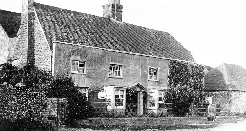
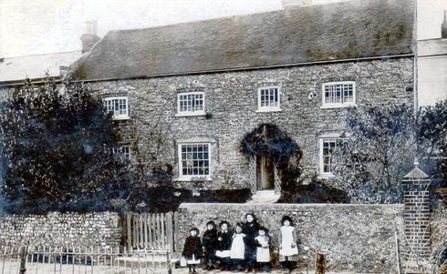
The Old Farmhouse, Fulking, in the 1900s

The Old Farmhouse, Fulking, in the 1900s


The Old Farmhouse is the only stone-faced building in Fulking and is believed to have been the original manor house. This property and Septima Cottages are probably the oldest buildings in the village. It is thought that the original building dates back to the 12th century and the mullioned windows and the east wall are 16th century. At one time a great hall extended north at the back of the house and a portion of the wall of this room remains part of the rear garden wall. The building has massive oak beams and one of the bedrooms has a floor of adzed oak planks, polished to a beautiful patina by many years of use. Up to 1930 the roof was finished with Horsham stone and until 1939 it had three staircases, but now has just two.

In the 1980s an elderly lady and broadcaster of Sussex history came to Fulking and gave a talk describing how she used to come to the village via the Dyke Railway just before war was declared in 1939. She lived with her aunt in The Old Farmhouse at one time and was able to show the present owner of the property where the third staircase had been located.

Stories associated with The Old Farmhouse abound. Smugglers are said to have used a hatch in the roof to pass kegs of brandy through to the shop next door. There is also supposed to be one, or possibly more, secret passages within the building. It has been suggested that one of these led to St Andrew’s Church in Edburton, but given the distance involved, this seems unlikely. Another theory is that the house was connected to the Shepherd and Dog for smuggling purposes, but so far, no evidence of the existence of either of these secret passages has been discovered.

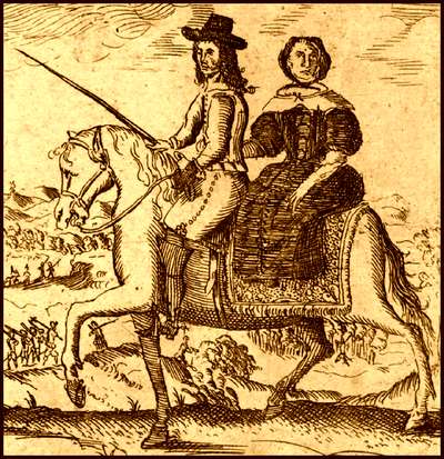
King Charles II, disguised as a servant, en route to France

King Charles II, disguised as a servant, en route to France

There is a small room where, in 1651, King Charles II is said to have hidden, before escaping over the Downs, via the bostal, to Shoreham harbour, from where he left for exile in France and it is thought that the house was also used as a refuge by folk able to leave London during the Great Plague in 1665, which also occurred during the reign of Charles II.

Yet another tale describes how, in 1940, a very attractive young lady and equally attractive young man stayed at the house. They were a very quiet couple who kept themselves to themselves and never socialised or talked to any of the villagers. It seems that subsequently they just disappeared and were never seen again. It was only much later that it was discovered that they had been arrested as spies.

Of course, the house is reputed to have a ghost. It seems that she takes the form of a charming, little, old lady, dressed in white who carries a bible. Apparently, she makes herself known mainly to children, but during WWII she was seen by seventeen Canadian soldiers who were billeted there in late 1943. These men went on to serve in the Italian campaign and during that time they wrote to friends in Fulking, telling how the old lady was always with them when ever they went into action and not one of them was wounded.

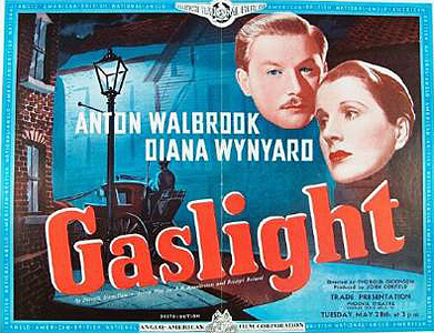
Poster for the 1940 film "Gaslight"

Poster for the 1940 film Gaslight

From the 1920s to the 1950s the house was used as a tearoom and a large white teapot was painted on the roof to attract customers, particularly walkers, who could see it quite clearly from the Downs. Between 1920 and 1939 this was run by Miss Dolly Coles and during this time her customers included the writers H.V. Morton, Ernest Raymond and Jeffrey Farnol. It was reputedly in these tearooms that a conversation on the merits of oil lamps versus electric lights took place (possibly around 1935 when electricity first came to Fulking), giving Patrick Hamilton the idea for his 1938 play Gas Light which was later made into two films (British 1940, American 1944). The tearooms reopened after the war and eventually closed in the 1950s.

Tony Brooks

[Copyright © 2012, Anthony R. Brooks. Adapted from Anthony R. Brooks (2008) The Changing Times of Fulking & Edburton. Chichester: RPM Print & Design, pages 156-158.]

Edburton and Fulking in the 1922 Kelly’s Directory for Sussex

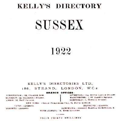
Title page of Kelly's Directory Sussex 1922

Title page of Kelly’s 1922 Directory for Sussex.

Frederic Festus Kelly was a senior Post Office official who purchased the rights to a London trade directory in 1835 and went on to become the most important 19th century publisher of commercial directories. A University of Leicester digital library project devoted to such directories observes that “Kelly’s success was based on the innovative content and formats of his publications. He championed the production of county and provincial directories covering all settlements in a given area. These provided a wealth of information about each place, often including a commercial, street and classified trades section. He also retained the title of Post Office Directory for some time, giving his publications an aura of officialdom.” There is an informative 1893 interview, “The Baedeker of Babylon” [PDF], with Kelly’s grandson about how the directories were compiled.

EDBURTON (anciently Eadburga’s Town) is a parish 4 miles east from Bramber Station on the Horsham and Shoreham section of the London, Brighton and South Coast railway, 10 north-west from Brighton and 53 from London, in the Horsham and Worthing division of the county, hundred of Atherington and Poynings, rape of Bramber, union and petty sessional division of Steyning, county court district of Brighton, and in the rural deanery of Hurst, archdeaconry of Lewes and diocese of Chichester.

The church of St. Andrew is of flint and stone, in the Early English style, and has a tower containing 3 bells: nine of the windows are stained: the font is of lead, and dates from 1180: the church was restored in 1878, at a cost of £1,573, and has 225 sittings. The register dates from the year 1559. The living is a rectory, net yearly value £320, with residence, in the gift of the Archbishop of Canterbury, and held since 1913 by the Rev. Edward Griffith Evans M.A. of Clare College, Cambridge, hon. O.F.

Lord Leconfield, who is lord of the manor, and the Crown are the principal landowners. The soil is green sand, clay and part gravel; subsoil, chalk and clay. The chief crops are wheat, barley, oats and potatoes. The area is 1,094 acres; rateable value, £735; population in 1911 was 114 in the civil and 302 in the ecclesiastical parish.

Letters through Small Dole. Upper Beeding is the nearest telegraph office. Poynings is the nearest money order office, 2 miles distant. Wall Letter Box near the church.

Public Elementary School (mixed), rebuilt in 1873, enlarged in 1883, for 75 children; Miss Averil Haigh, mistress.

  • J. Clayton J, M.I.O.E. Clappers Lane
  • Rev. Edward Griffith Evans M.A. (Hon. C.F.), Rectory
  • Henry Harris, farmer, Perching Manor
  • John Radcliffe Passmore, farmer, Edburton Farm
  • John Powell, market gardener
  • Walter Augustus Powell M.R.C.S., L.R.C.P.Lond. physician & surgeon
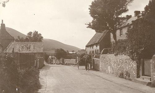
The Street, Fulking, c1910

The Street, Fulking, circa 1910.

FULKING, Folking or Faulking (in Domesday Fochinges), in the ecclesiastical parish of Edburton, was constituted a separate civil parish under the “Local Government Act of 1894.” It is about 4 miles east from Bramber station on the Horsham and Shoreham section of the London, Brighton and South Coast railway and 8 north-west from Brighton, in the Lewes division of the county, Steyning union and petty sessional division and Brighton county court district. The Crown is lord of the manor. The soil is green sand, clay and part gravel; subsoil, chalk and clay. The chief crops are wheat, barley, oats and potatoes. The area is 1,552 acres; rateable value, £1,546; the population in 1911 was 188.

Post Office: Percival Lucas, sub-postmaster. Letters through Small Dole, Sussex. Poynings is the nearest money order office, 1 mile distant. Pyecombe is the nearest telegraph office, 3 miles distant.

  • Major Albert Adams, Old Farm House
  • Robert Atkins, The Croft
  • Mrs. Black
  • Charles E. Clayton, Holmbush Lodge
  • Laurence Clayton, Badger Wood
  • Samuel Payne, Fulking House
  • Duncan Sinclair, Hall Farm

COMMERCIAL

  • Mrs. Maria Baldey, Shepherd & Dog Public House
  • Thomas S. Hills, farmer and assistant overseer, Fulking Farm
  • Percival Lucas, grocer, Post Office
  • Arthur Pinker, farmer
  • Joseph Robinson, farmer, Perching Sands
  • Henry William Uridge, farmer

[All material transcribed, with minor formatting and punctuation changes, from pages 359, 360 and 373 of the 1922 edition of Kelly’s Directory for Sussex, published by Kelly’s Directories Ltd., London.]

GJMG