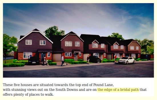
The edge of a bridal path
The community website of the village of Fulking, West Sussex

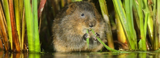
The SDNPA’s annual review for 2013-14 has just been published. The first achievement listed in the press release is the provision of 450 water voles to the River Meon. Other highlights include resurfacing just under a mile of the South Downs Way, replacing 46 signposts and repairing or replacing 24 gates. The full report is here [PDF].
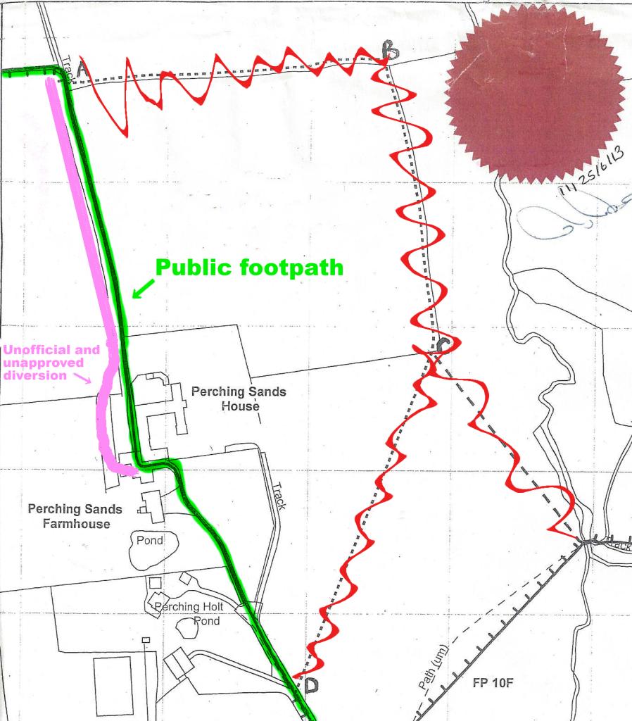
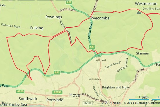
The DEFRA inspector charged with deciding whether Footpath 4f should be rerouted has ruled that it should not be. He concluded “that the adverse effect on the public’s enjoyment of the path if it were diverted in the manner proposed would be significant” and “the adverse effect on public enjoyment clearly outweighs the benefit .. to the landowners”. The proposed diversions (crossed out in red, above) will thus not come into force. Instead, the historic route (marked in green, above) retains its status as a lawful right of way. Here are some extracts from his report:
Footpath 4f runs .. almost immediately adjacent to the rear of Perching Sands House for around 40 metres. The public right of way runs past Perching Sands House in the way described, but that right of way has been unlawfully obstructed, and an unofficial path has been provided which passes some 10 metres to the west of the house.
The public right of way has been obstructed in the vicinity of Perching Sands House. For the purposes of assessing comparative convenience (and enjoyment) I take into account the lawful right of way, treating it as if it was open and available for use, and not the unofficial and unapproved diversion which has been created by the landowner.
From the northern end of the curtilage of Perching Sands House to point A the right of way (although not the path provided by the landowner which lies immediately to its west) runs along a track with a good hard surface which seems unlikely to be muddy in wet weather (the site visit was carried out during a prolonged dry spell). The Definitive Statement for the path does not list any stiles or gates as lawful limitations on the public’s use.
It is reasonably clear where the path runs (or should run), and the correct route could be emphasised by signage so that there was no danger of people inadvertently wandering off the public right of way.
The full report is here [PDF].
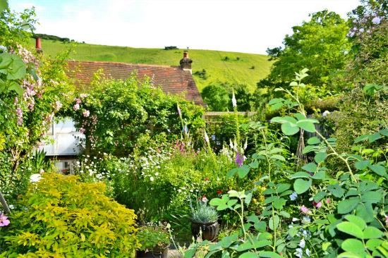
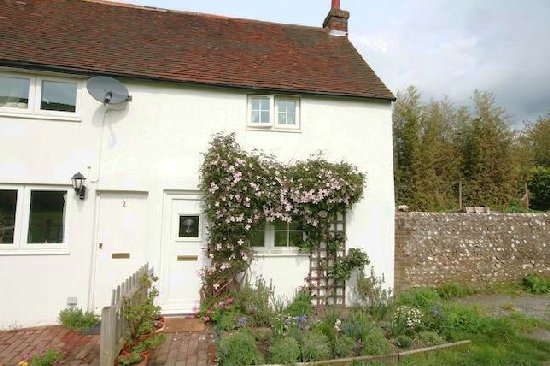
Southview Cottages (although officially part of The Street) are situated at the western end of Fulking bridleway 6c (the Backway) and as their names suggest they face south with uninterrupted views of the Downs. They were built in the 16th century and at one time owned by G.S.C. Cuttress who included them in the sale of his property in 1914. At that time they were described [in the auctioneer’s catalogue] as: “A double tenement cottage with garden and frontage to an accommodation road. Each tenement contains two bedrooms, a living room, washroom with copper and a lean-to wood shed. [There was] A privy in the garden common to the two tenements.” At the time of the sale. the two tenements were let as one to James Steel at 3 shillings and 4 pence per week, the landlord paying rates and taxes. It is of note that a condition of the 1914 sale was that the purchaser of Southview Cottages had no third party right of access to The Street, over the land associated with Septima Cottages and the purchaser of Septima 1 and 2 had the right to deny any such access.
At some time between 1920 and 1930, Amy Harris bought the cottages and they were let to labourers working at Perching Manor Farm. Following the Second World War they were no longer required for farm employees and were let out to non-farm workers. Number 1 remained in the ownership of the Harris family until 2006.
Tony Brooks
[Copyright © 2014, Anthony R. Brooks. Adapted from Anthony R. Brooks (2008) The Changing Times of Fulking & Edburton. Chichester: RPM Print & Design, page 178.]
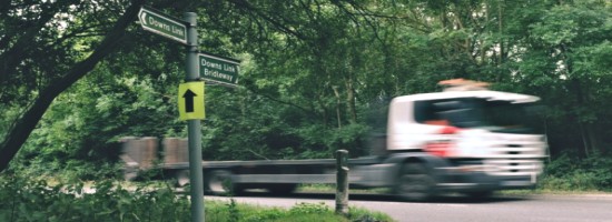
The Shoreham Herald reports that work is about to begin on the new bridleway that will allow users of the Downs Link to avoid having to cross the A283.
David Barling, county councillor for Bramber Castle, said ..
The underpass scheme is intended to provide a much better and safer route for walkers, cyclists and horse riders by removing the need to cross the open A283 bypass, which is extremely dangerous, you usually take your life in your hands crossing at this point.
Edburton Contractors, working for West Sussex County Council, is programmed to begin initial clearance works [today]. Mr Barling explained:
This means having a look at the site and clearing scrub and trees or tree roots that may need removal along the highway verge. This initial phase will take a couple of weeks and then proper construction works will start on Monday, August 18, and it is hoped that these will last no more than four weeks to complete. The finished pathways will then be left to settle down for a couple of weeks more and then [be] fully open to pedestrians, cyclists and horse riders.
The Argus reports:
Brighton and Hove City Council has created free public access to another 670 acres of Sussex downland. .. Five miles of new footpaths and bridleways have been created, meaning walkers on the Sussex Border Path can divert on to a route keeping them further away from busy roads. Works have involved installing gates and cutting a new path up a steep bank at Braypool. .. The surrounding landscape includes ancient burial mounds on top of Tegdown Hill, lynchet terraces .. and the Chattri monument.

Saturday 26th July, 10:00am onwards, free admission, proceeds to local charities.
Trailer rides, traction engines, vintage tractors, farm animals, donkey rides, ferret racing, dog scurry racing, airgun target shooting, archery, barbecue, ginger wine, and real ale.
The farm is due south of Perching Manor and you can walk there from Fulking without crossing a single public road. There are two quite different routes so you can make an interesting circular walk out of a visit. A copy of OS Explorer 122 will prove useful if you haven’t done it before.

Readers of the Yr Arolygiaeth Gynllunio report [PDF] cannot help but notice that the inspectors were much exercised by Tottington Mount. It is discussed or referenced on no fewer than 32 pages. By contrast, there isn’t a single reference to Truleigh Hill anywhere.
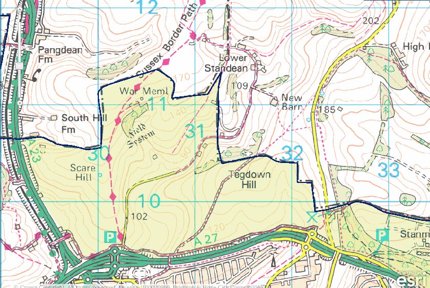
Tottington Mount lies between the Truleigh Hill Youth Hostel and Tottington Manor Farm. There is a public footpath opposite the farm that will take you up and across the mount. It is extremely steep for much of the route. Apart from the splendid view to the north, there’s not much to see. You will pass a long low earthwork as you near the summit. The mount itself just looks like canonical downland to an inexpert eye. As the map above indicates, the trench will bisect the mount.
Tottington Mount is a virgin patch of Downs that has never been ploughed. As a consequence, it hosts noteworthy plant species (page 57). The works area for the trench is to narrow from 30-40 metres to 20-30 metres as it cuts across the area (page 94). E.ON will be spending £330K on bog matting and other mitigation expenses on this small section of the trench (page 38). Some details of the mitigation plans, and the SDNPA’s scepticism about them, can be found on pages 57-58. The inspectors think that these mitigation efforts may well fail (page 41). The trench will skirt the Beeding Hill to Newtimber Hill SSSI (Site of Special Scientific Interest) with a margin of about 50 yards at Tottington Mount. Disturbance to the chalk grassland species living within the SSSI will be ‘negligible’, apparently. Indeed, these species are set to benefit significantly from all the environmental monitoring that will be happening at Tottington Mount as part of the mitigation exercise (pages 52-53). However, Adonis Blue caterpillars may not share this upbeat view — they risk losing their lunch (pages 67-68).
The earthwork is a Bronze Age cross dyke and is listed as an ancient monument. The trench will go right through it (click the map above to see the detail of this), something that English Heritage refers to as a “substantial harmful effect” (page 178). The good news is that archaeologists will be funded to root around in the rubble — “appropriate archaeological supervision” (page 179, pages 398-399) — and English Heritage felt able to rule that “the harm is necessary in order to deliver substantial public benefits that outweigh the harm” (page 178). In turn, the inspectors concluded that there will be “be no loss of significance of any designated or undesignated heritage asset” (page 182) notwithstanding the “risk of adverse effects upon heritage assets, including the Tottington Mount Scheduled Ancient Monument” (page 227).
The South Downs National Park Authority has another relevant press release on this topic:
UK Power Networks, which delivers electricity supplies in the South East, has just completed a project to remove 1.4 miles of power lines, poles and equipment at the Rathfinny Wine Estate. .. The £426,513 improvements were funded by the electricity distributor’s £6.6 million initiative to enhance nationally-protected landscapes. New underground cables have been laid to replace the power lines on the wine estate and National Trust’s Frog Firle Estate.
Pete Currell, from the South Downs National Park Authority, said: “This underground cabling is just one of three schemes happening in the National Park over the next two years and we hope that we’ll be able to announce two more in the very near future.”
The projects are chosen by a regional steering group of environment experts, including the South Downs National Park, and chaired by Natural England. UK Power Networks provides technical support and guidance and carries out the projects. Between 2010 and 2015 UK Power Networks has £6.6million to invest in projects to replace overhead lines with underground cables in AONBs and National Parks in the South East. Since 2005 the company has removed 86km of power lines to enhance some of Britain’s most important landscapes.
Earlier post here.